Island Beach Access
Whidbey Island Sea Kayakers (WISK) – Round the Island Paddle #8: Clinton Beach Park to Glendale
General area of island: SOUTH
Nearest town or community: Clinton, WA
Point to Point launch sites: #54 Clinton Beach & Park to #55 Glendale
Difficulty: Skill level I-II depending on conditions
Paddle distance/time (one way): 2.5 mi
Access: Ref: Getting to the Water’s Edge
- Site #54: Clinton Beach Park Lat/Long: N 47: 58.498 W: 122: 21.048
Located just N of the Clinton ferry. Limited parking at Clinton Park. Limited # spaces and 4 hr time limit but appears not to be strictly enforced. You must to carry your kayak over some logs to launch. - Site #55: Glendale Lat/Long: N 47: 56.386 W: 122: 21.459
Near the S. end of Hwy 525 just uphill from the ferry, turn R (South) onto Humphrey Rd. Drive S about 3 mi. to the bottom of the hill to Glendale and Seaway lane. Just upward from the channel and obvious launch site you will find a short gravel parking area between two houses. The tidelands in front of the parking area are private. Public access is a 30 ft road width only to the meander line.
Special features, attractions, points of interest, warnings: (e.g., best times to paddle, wildlife, scenery)
Pleasant short and relatively safe paddle. Good views from Mt Baker to Mt Rainier on a clear day (rare as that may be). Lots of shoreline homes to admire for about half the trip.
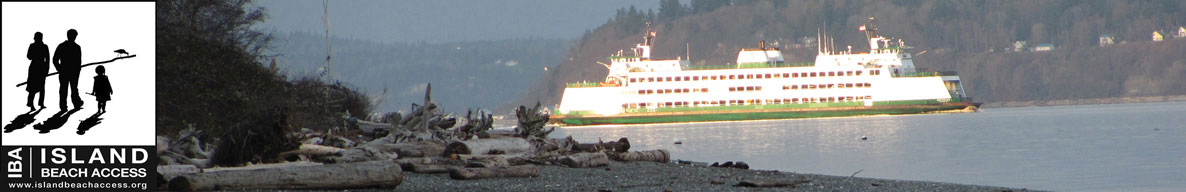
Going S., you will immediately encounter the ferry dock. Paddle under it except at very high tide. If you go around, stay well clear of the ferries. Ferries create severe backlash. The Columbia Beach houses to the south end about 1 mi. S. Go another 1.5 mi to the Glendale beach past undeveloped beaches. Best to go with the tide or a slack tide. Current goes N at 1.5-2.0 knots on an incoming tide from the S. Glendale Rd parking is limited and the tide-lines in front of the access are private. Fairly high access to the beach.
Optionally, and for a longer paddle, proceed S toward Possession Beach.
KAYAKING SKILL LEVEL MATRIX (from Hole in the Wall Paddling Club newsletter)
| SKI | SKII | SKIII | SKIV | SKV | SKVI | |
|---|---|---|---|---|---|---|
| Geography (fetch: distance of unimpeded wind) |
Protected from wind & waves |
Fetch less than 10 nautical miles |
Fetch more than 10 nautical miles |
Crossings up to 5 nautical miles |
Crossings over 5 nautical miles |
Landings may be impossible |
| Hydraulics | Insignificant currents |
Max current 1 knot |
Max current 2 knots |
Currents above 2 knots |
Currents faster than paddle speed |
Anything possible |
| Route | Day trips nearshore |
Crossings less than 1 nautical mile |
Eddy lines & tiderips possible | Strong eddy lines, tiderips & boils |
Possible launching & landing in surf |
Anything possible |
| Possible conditions | Calm | Winds less than 10 knots |
Wind possibility more than 10 knots |
Steep waves, swells & wind over 15 knots |
Foul weather, whitecaps and fast current |
Rescues may be impossible |
| Skills & expertise | Willing to learn |
Wet exits and rescues |
Group & self rescue; bracing |
Reflexive bracing, navigation |
All skills plus roll recommended |
Extensive surfing |
Information supplied by Whidbey Island Sea Kayakers – May the kelp be with you.