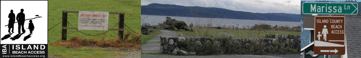
Island Beach Access
Whidbey Island Sea Kayakers (WISK) – Round the Island Paddle #23: ALA SPIT TO DUGUALLA
General area of island: NORTH – Eastside
Nearest town or community: Deception Pass State Park and Oak Harbor
Point to Point launch sites: Ala Spit to #7 Dugualla Bay
Difficulty: Skill level II-II (See chart below)
Paddle distance/time (one way): 2.9 mi
Access: Ref: Getting to the Water’s Edge
- Site #5: Ala Spit Lat/Long N 48: 23. 581 W 122: 35.200
Turn E off Hwy 30 2 mi S. of Deception Pass Bridge onto Troxell Rd. Travel 4 mi. to Geck Rd. Drop down to road end. Site has limited parking and a porta-potty. Carry kayaks over a few logs. Not easy. - Site #7: Dugualla Bay Dike Access: Lat/Long N 48: 21.398 W 122: 35.891
From Hwy 20 N. of Oak Harbor go L (East) onto Frostad Rd. After 0.8 mi. go N onto Dike Rd. Park on road shoulder at midpoint of dike.
Go W onto Swantown Rd. Then 3 mi. to stop sign at T intersection with Crosby Rd. The entrance is on the N. side of Crosby. There are 2 parking areas with no facilities. One is near West Beach Rd, at the N. End of a line of waterfront houses. See GWE book for more detailed instructions.
Special features, attractions, points of interest, warnings: (e.g., best times to paddle, wildlife, scenery)
This is almost always a very easy paddle. Lots of bird life to observe, especially kingfishers and herons. At low tide, Dugualla Bay empties to almost Ľ mile out from the launch area, and the exposed mudflat is a rich feeding area for birds. The flight path for one of the Navy Base’s runways is directly over Dugualla Bay, so it could also get a little noisy overhead!
You’ll want to do this paddle at a high tide, whether you launch from Ala Spit or Dugualla Bay. In fact you can only launch at a high tide at Dugualla Bay. At Ala Spit a mammoth barrier of logs on the south side of the spit makes carrying your kayak between the parking lot and the beach difficult. A partner is almost mandatory. Best not to consider launching or landing on the north side of the spit. Too muddy.
KAYAKING SKILL LEVEL MATRIX (from Hole in the Wall Paddling Club newsletter)
| SKI | SKII | SKIII | SKIV | SKV | SKVI | |
|---|---|---|---|---|---|---|
| Geography (fetch: distance of unimpeded wind) |
Protected from wind & waves |
Fetch less than 10 nautical miles |
Fetch more than 10 nautical miles |
Crossings up to 5 nautical miles |
Crossings over 5 nautical miles |
Landings may be impossible |
| Hydraulics | Insignificant currents |
Max current 1 knot |
Max current 2 knots |
Currents above 2 knots |
Currents faster than paddle speed |
Anything possible |
| Route | Day trips nearshore |
Crossings less than 1 nautical mile |
Eddy lines & tiderips possible | Strong eddy lines, tiderips & boils |
Possible launching & landing in surf |
Anything possible |
| Possible conditions | Calm | Winds less than 10 knots |
Wind possibility more than 10 knots |
Steep waves, swells & wind over 15 knots |
Foul weather, whitecaps and fast current |
Rescues may be impossible |
| Skills & expertise | Willing to learn |
Wet exits and rescues |
Group & self rescue; bracing |
Reflexive bracing, navigation |
All skills plus roll recommended |
Extensive surfing |
Information supplied by Whidbey Island Sea Kayakers – May the kelp be with you.